
A Revolutionary Data Monitoring Software for Enhanced Geotechnical Insights
Soil Instruments Limited, a global leader in geotechnical instrumentation and monitoring solutions, proudly announces the launch of Sensly, its cutting-edge Data Monitoring Software. This innovative software, designed to replace the existing Argus platform, represents a significant leap forward in geotechnical data management.
Sensly operates on a secure cloud technology platform, offering a host of unparalleled features that cater to the evolving needs of geotechnical professionals. The software provides an intuitive and user-friendly interface, ensuring a seamless and efficient experience for users at all levels of expertise.
Key features of Sensly include:
- User-Friendly Interface: Sensly boasts an intuitive and user-friendly interface, making it accessible for professionals at all skill levels. The streamlined design enhances user experience and facilitates efficient data management.
- Secure Login and User Access Levels: Ensuring the utmost security, Sensly offers a robust login system with customizable user access levels. This feature enhances data protection and privacy, allowing organizations to control access based on specific roles and responsibilities.
- Customisable Dashboards: Geotechnical professionals can tailor their monitoring experience with customizable dashboards, providing a personalized and efficient overview of critical data. This flexibility empowers users to focus on the information most relevant to their projects.
- Email Alerts: Sensly’s real-time email alert system enables users to stay informed about crucial developments in their monitored data. Instant notifications allow for swift responses to any anomalies or noteworthy events.
- Data Editing and Export: With Sensly, users can easily edit and export data, facilitating a dynamic and interactive data management process. The software’s advanced capabilities empower professionals to derive meaningful insights from their geotechnical data.
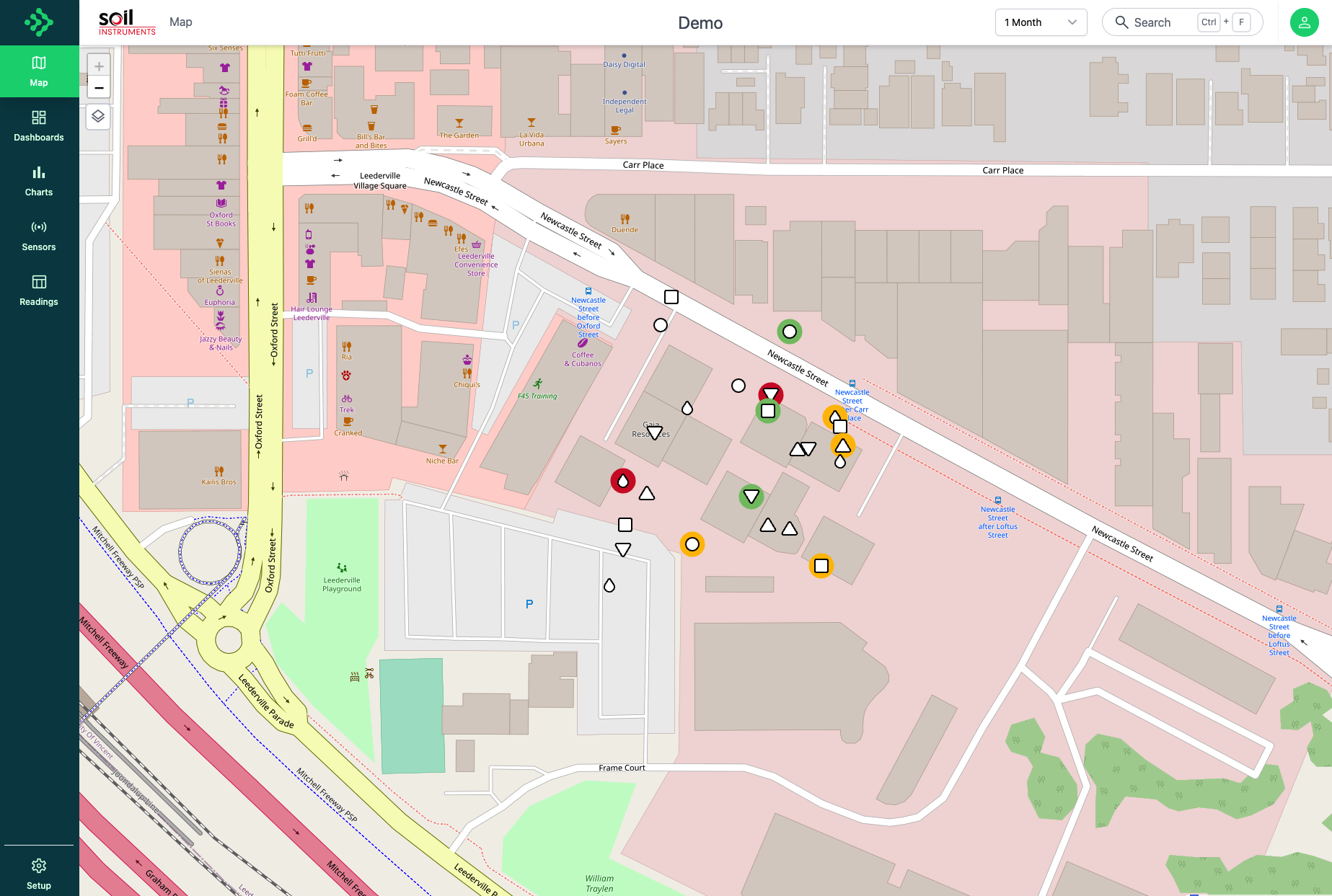
- Map Image Layers: Sensly integrates map image layers, providing a comprehensive and visually rich representation of geotechnical data. This feature enhances spatial analysis and enables users to visualize and interpret data in a geospatial context.
Sensly is available immediately for clients seeking to transition from their existing data monitoring software to this groundbreaking platform. Additionally, it is readily deployable for use with new projects, offering a future-ready solution for geotechnical monitoring needs.
Speaking about the launch, David Welch, Global Sales & Marketing Manager, at Soil Instruments Limited, said, “Sensly marks a significant milestone in our commitment to delivering innovative solutions to the geotechnical community. With its advanced features and secure cloud technology, Sensly empowers professionals to make informed decisions based on accurate and real-time data. We are confident that Sensly will set a new standard in geotechnical data monitoring.”
For more information about Sensly, contact: David Welch, Global Sales and Marketing Manager on T.+44 (0) 1825 765044, e:sales@soilinstruments.com or website : www.soilinstruments.com.